Monday, August 19, 2013

NGORONGORO THE WORLD HERITAGE SITE


 NGORONGORO CONSERVATION AREA


Craters & Wildlife


Encompassing three spectacular volcanic craters, the Olduvai Gorge, huge expanses of savannah, forest and bush land, the Ngorongoro Conservation Area is the flagship of Tanzania'stourism industry.
The Ngorongoro Conservation Area (NCA), measuring 8,300 square kilometres, is also the only place on earth where mankind and wild animals co-exist in harmony. The NCA became a Man and Biosphere Reserve in 1971 and was declared a World Heritage Site by UNESCO in 1979.
Originally part of the Serengeti National Park when the latter was established by the British in 1951, in 1959 the Ngorongoro Conservation Area Authority (NCAA) was formed, separating NCA from Serengeti. Land within the area is multi-use, providing protection status for wildlife while also permitting human habitation. Its uniqueness lays in the fact that the NCA is where man, livestock and wild animals live in peace: Maasai cattle can sometimes be seen grazing alongside zebras on Ngorongoro's grassland.
Apart from conserving world heritage, Ngorongoro plays a major role in national development. "We pay 30 per cent corporate tax, 3 per cent tourism tax, and remit 10 per cent of our earnings to the treasury", explains Bernard Murunya, the NCAA's Chief Conservator. "We also give over US$125,000 to the local District Council as well as supporting the area's Pastoralist Council, in addition to funding various community projects such as schools, hospitals, veterinary services and road construction," he adds.

World Heritage site

The NCCA's wildlife and land has been a UNESCO site since 1979 and now its cultural heritage is to be included. The NCA is the only site in the world with a high concentration of wildlife living in harmony with human communities. The multiple land use systems in this area are among the earliest to be established around the world as a means of reconciling human development and conserving natural resources. The
NCA also contains numerous paleontological, archaeological, and anthropological sites of exceptional quality.

The Main Crater 


Had it not become the world's sixth-largest unbroken caldera, then what is now known as the Ngorongoro crater could have been a towering volcanic mountain, as high as Kilimanjaro.
The crater is the flagship tourism feature for the Ngorongoro Conservation Area. It is a large, unbroken, un-flooded caldera, formed when a giant volcano exploded and collapsed some three million years ago. The Ngorongoro crater sinks to a depth of 610 metres, with a base area covering 260 square kilometres. The height of the original volcano must have ranged between 4,500 to 5,800 metres high. Apart from the main caldera, Ngorongoro also has two other volcanic craters: Olmoti and Empakai, the former famous for its stunning waterfalls, and the latter holding a deep lake and lush, green walls.
On the leeward of the Ngorongoro highlands protrudes the iconic Oldonyo Lengai, an active volcano and Tanzania's third highest peak after Kilimanjaro and Meru. Known to local people as the Mountain of God, Mount Lengai's last major eruption occurred in 2007. At the mountain's foot is Lake Natron, East Africa's major breeding ground for flamingoes.

Flora and Fauna: Wildlife

The area contains over 25,000 large animals including 26 black rhinoceros. There are 7,000 wildebeests, 4,000 zebras, 3,000 eland and 3,000 Grant's and Thomson's gazelles. The crater also has the densest known population of lions, numbering 62. Higher up, in the rainforests of the crater rim, are leopards, about 30 large elephants, mountain reedbuck and more than 4,000 buffalos, spotted hyenas, jackals, rare wild dogs, cheetahs, and other felines.
The legendary annual wildebeest and zebra migration also passes through Ngorongoro, when the 1.7 million ungulates move south into the area in December then move out heading north in June. The migrants passing through the plains of the reserve include 1.7 million wildebeest, 260,000 zebra, and 470,000 gazelles. The Lake Ndutu area to the west has significant cheetah and lion populations. Over 500 species of bird have been recorded within the NCA. These include ostrich, white pelican, and greater and lesser flamingo on Lake Magadi within the crater, Lake Ndutu, and in the Empakaai Crater Lake, where a vast bird population can be observed.


Flora and Fauna: Vegetation cover

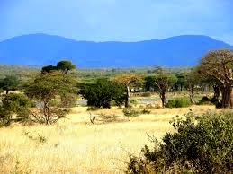
Ngorongoro is home to lush green, rain-watered vegetation, as well as desert plants. The area has uncultivated lowland vegetation, arid and semi-arid plant communities, abundant short grass used for grazing, and highland forests.
Scrub heath, grasslands, high open moorland, and the remains of dense evergreen forests cover the steep slopes of the crater, while highland trees including Peacock Flower, Yellow-Wood, Kousso (Hagenia abyssinica), and Sweet Olive can also be found. There are also extensive stretches of pure bamboo on Oldeani Mountain, and Pencil Cedar on Makarut Mountain to the west. Dove- weeds dominate the lower slopes, while the upland woodlands contain Red Thorn Acacia and Gum Acacia that are critical for protecting the watershed.
The crater basin is covered by open short grass plains with fresh and brackish water lakes, marshes, swamps, and two patches of Acacia woodland. The Lerai Forest is home to the Yellow Fever tree and Acacia, while Laiyanai Forest has Pillar Wood and Acacia Lahai. The undulating plains to the west are grass-covered with occasional Umbrella Acacia and Commiphora Africana trees. Blackthorn Acacia and Zebrawood dominate in the drier conditions beside Lake Eyasi. These extensive grasslands and bush are rich, relatively untouched by cultivation, and support very large animal populations.


Where human life began

At far end of the NCA stands the Olduvai Gorge archaeological site, widely regarded as the cradle of mankind and the most important prehistoric site in the world. It is at Olduvai where remains of Zinjanthropus, the world's first humans, were discovered by Dr Louis and Mary Leakey over 50 years ago. The earliest known specimens of the human genus, Homo-habilis, as well as early hominids such as Paranthropus boisei have also been found there. The Olduvai Gorge is a steep-sided ravine in the Great Rift Valley, stretching along eastern Africa. The windswept Olduvai is about thirty miles long, lying within the rain shadow of the Ngorongoro highlands. The gorge is named after oldupaai, the Maasai word for the wild sisal plant.
Millions of years ago, the site comprised of a large lake, the shores of which were covered with successive deposits of volcanic ash. Some 500,000 years ago seismic forces diverted a nearby stream, which began to cut down into the sediments, revealing the seven main layers in the walls of the gorge. Based on fossil evidence found at the Olduvai Gorge, it is believed that various hominid species have been occupying the crater continuously for the past three million years of Ngorongoro's existence. Native hunter and gatherers who initially lived in the vicinity were replaced by pastoralists a few thousand years ago.


What to See

People and Culture (Maasai)


For thousands of years a succession of cattle herding people moved into the Area, lived here for time, and then moved on, sometimes forced out by other tribes.
About 200 years ago the Maasai arrived and have since colonized the Area in substantial numbers, their traditional way of life allowing them to live in harmony with the wildlife and the environment. Today there are some 42,200 Maasai pastoralists living in the NCA with their cattle, donkeys, goats and sheep. During the rains they move out on to the open plains; in the dry season they move into the adjacent woodlands and mountain slopes. The Maasai are allowed to take their animals into the Crater for water and grazing, but not to live or cultivate there. Elsewhere in the NCA they have the right to roam freely.
Visitors are welcomed at two designated Maasai cultural bomas one on the road to Serengeti and another close to Sopa Lodge at Irkeepusi village.
The Datoga, Nilo-Hamitic-speaking pastoralists, who arrived more than 300 years ago and were subsequently forced out of the Serengeti-Ngorongoro area by the Maasai, today they live just outside the NCA, in the Lake Eyasi basin and beyond.

Cultural Bomas


Oldupai Gorge & Laetoli

Over the last thirty years or so, it has become increasingly apparent that Africa is probably the “Cradle of Mankind”. From Africa they spread out to populate the rest of Earth. Remains of the earliest humans were found in Oldupai Gorge.


Oldupai Gorge (originally misnamed Olduvai) is the most famous archaeological location in East Africa, and has become an essential visit for travelers to Ngorongoro or Serengeti.
At Laetoli, west of Ngorongoro Crater, hominid footprints are preserved in volcanic rock 3.6 millions years old and represent some of the earliest signs of mankind in the world. Three separate tracks of a small-brained upright walking early hominid. Australopithecus afarensis, a creature about 1.2 to 1.4 meters


high, were found. Imprints of these are displayed in the Oldupai museum.
More advanced descendants of Laetoli’s hominids were found further north, buried in the layers of the 100 meters deep Oldupai Gorge. Excavations, mainly by the archaeologist Louis and Mary Leakey, yielded four different kinds of hominid, showing a gradual increases in brain size and in the complexity of their stone tools. The first skull of Zinjanthropus, commonly known as ‘Nutcracker Man’ who lived about 1.75 millions years ago, was found here. The most important find include Home habilis, Zinjathropus and the Laetoli footprints.
The excavation sites have been preserved for public viewing and work continues during the dry seasons, coordinated by the Department of Antiquities. One may visit Oldupai at all times of the year. It is necessary to have official guide to visit the excavations. At the top of the Gorge there is small museum, a sheltered area used for lectures and talks, toilets and a cultural boma. Local Maasai souvenirs are also available.
Thus, Oldupai and Laetoli makes the Ngorongoro Conservation Area an important place in the world for the study of human origins and human evolution.

Discover the world as it was when we were once all African.
Visit a Modern-Day Eden.


The Ngorongoro Conservation Area (NCA) - where people and their early ancestor have co-existed with wildlife for nearly four million years. This World Heritage Site and International Biosphere Reserve encompasses a spectacular mosaic of landscape that includes the breath-taking Ngorongoro Crater and the legendary Serengeti - the annual host of the World’s highest concentration and diversity of migratory animals numbering nearly two-million strong. As if this wasn’t enough, the NCA also contains two important and internationally-known fossil and archaeological sites: Laetoli and Olduvai Gorge. Both continue to contribute significantly to understanding of humankind’s physical, behavioral and technological evolution.
The Olduvai Gorge Museum and Visitors Center offer numerous educational exhibits, including fossils and artifacts of our human ancestors and skeletons of many extinct animals who shared their world. There are also informative lectures, special guided archaeological sites tours, native handcrafts and a well-stocked bookshop. See and learn about our collective human origins when we were once all Africans.

The Laetoli Footprints: First Steps on the Road to Humankind

See and touch a huge cast of actual footprints made by our early human ancestors (hominins ) known as “Lucy" Australopithecus afarensis. The prints of three hominins were miraculously preserved in muddy ash deposited by volcanic eruptions and hardened by the sun some 3.6 million years ago.
Made by feet little different than our own, they proved conclusively that these creatures stood and walked upright (bipedally) with a human-like stride a million years before the invention of stone tools and the initial growth in hominin brain size. It’s undoubtedly one of the most astounding and important scientific discoveries of our time.
A complete room of the Olduvai Museum devoted to the hominin footprint trail.

Walk in the Grand Canyon of Humankind

Some 30,000 years ago, splitting of the earth’s surface by violent geological activity and millennial of erosion by seasonally flowing streams incised the nearly 250 foot (90m) canyon known as Olduvai Gorge. These natural forces exposed a remarkably rich geological chronicle of human ancestry and the evolution of the Serengeti ecosystem. It was here that Mary and Louis Leakey unearthed the first well-dated artifacts and fossils of some of our earliest human ancestors after over 30 years of painstaking work. These include the famous Zinjanthropus (Australopithecus boisei) skull, homo habills, the presumed maker of the numerous early stone tools in the 1.8 to 1.6 million year-old deposits, and homo erectus, the larger bodied, larger brained hominin that preceded the earliest modern humans (Homo sapiens). Special archaeological tours guided by the Department of Antiquities personnel are available and include the remarkable Shifting Sands.


Flamingos & Bird Watching

Flamingos

Flamingos are very common at lakes in the NCA, all of which are saline. Flamingos are filter feeders and feed on plankton. Plankton is a collective name for microscopic plants and animals that occur in the mud and on the surface of shallow, saline lakes.


Bird Watching

The mixture of forest, canyons, grassland plains, Lakes and marshes provide habitats for a wide range of bird life. The wet months see the arrival of the Eurasian migrants at the pools. White storks, yellow wagtails and swallows mingle with the local inhabitants: stilts, saddle-bill storks, ibis, ruff and various species of duck. Lesser flamingos fly in to feed from their breeding grounds at Lake Natron. Distinctive grassland birds – ostrich, kori bustards and crowned cranes-abound. The rest of the NCA also has areas which will reward the keen ornithologist.


Beyond The Craters

Lake Ndutu


Lake Ndutu and Lake Masek form shallow basins where water accumulates from the nearby areas of slightly higher altitude. The water in both lakes are extremely saline, too saline for human consumption. Lake Ndutu becomes alive with animals during the migration because it is surrounded by the Ndutu woodlands and the Short Grass Plains, which provide ample cover and food.

Oldonyo Lengai

Located just outside the NCA, to the north-east near Lake Natron, this Volcano, whose Maasai name means ‘Mountain of God’, has had a major influence on the development of the area. It rises 1830m above the Valley floor. Its ash has been blown westwards onto the plains and helped shape the landscape and ecology. It is the only active volcano in the area, having erupted in 2006 and more recently July this year (2007).

The Shifting Sands


This remarkable black dune, composed of volcanic ash from Oldonyo Lengai, is being blown slowly westwards across the plains, at the rate of about 17 meters per year. Some 9 meters high and 100 meters long in its curve, it can be found to the north of Oldupai Gorge.

Olkarien Gorge 


The Gorge is ecologically important because it is a vital nesting site of the Ruppell’s Griffon Vulture. The best time to visit Olkarien Gorge is from March to April when the vultures are breeding. This coincides with migration when there is plenty of food available.


Hotels and accommodation

The area has some of the best hotels and lodges in Tanzania, such as the classic Ngorongoro Crater Lodge, built in 1939, and now operated by the And Beyond group of South Africa, along with the Ngorongoro Rhino Lodge, built in 1942, the Ndutu Lodge, built in 1946, and the Ngorongoro Wildlife Lodge, dating back to 1971.
Newer establishments include the Ngorongoro Sopa Lodge and Ngorongoro Serena Lodge, built in the mid- 1990s. The six facilities, all located along the crater rim, have a total bed capacity of 560. The NCAA also has 16 campsite areas. Three more firms, the Whitesands, Kibo Safaris, and Coastal travels intend to establish other facilities within NCA; the new entries will boost the area bed capacity to 1,000.

Famous visitors

About 450,000 tourists visit Ngorongoro every year, accounting for 60 per cent of the average 770,000 tourists visiting Tanzania per annum. Famous visitors include former US President Bill Clinton, the Queen of Denmark Magrethe II, former American Human Right Activist the Rev Jesse Jackson, Hollywood film star Chris Tucker, John Wayne, Prince William, and the entire delegation attending the 2008 Leon Sullivan Summit which took place in Arusha.
Some scenes from the Oscar winning Out of Africa and John Wayne's Hatari were filmed in Ngorongoro.

Thursday, August 15, 2013

VISIT MIKUMI NATIONAL PARK


Mikumi National Park


Swirls of opaque mist hide the advancing dawn. The first shafts of sun colour the fluffy grass heads rippling across the plain in a russet halo. A herd of zebras, confident in their camouflage at this predatory hour, pose like ballerinas, heads aligned and stripes merging in flowing motion.
Mikumi National Park abuts the northern border of Africa's biggest game reserve - the Selous – and is transected by the surfaced road between Dar es Salaam and Iringa. It is thus the most accessible part of a 75,000 square kilometre (47,000 square mile) tract of wilderness that stretches east almost as far as the Indian Ocean.
The open horizons and abundant wildlife of the Mkata Floodplain, the popular centrepiece of Mikumi, draw frequent comparisons to the more famous Serengeti Plains.
Lions survey their grassy kingdom – and the zebra, wildebeest, impala and buffalo herds that migrate across it – from the flattened tops of termite mounds, or sometimes, during the rains, from perches high in the trees. Giraffes forage in the isolated acacia stands that fringe the Mkata River, islets of shade favoured also by Mikumi's elephants.
Criss-crossed by a good circuit of game-viewing roads, the Mkata Floodplain is perhaps the most reliable place in Tanzania for sightings of the powerful eland, the world’s largest antelope. The equally impressive greater kudu and sable antelope haunt the miombo-covered foothills of the mountains that rise from the park’s borders.
More than 400 bird species have been recorded, with such colourful common residents as the lilac-breasted roller, yellow-throated longclaw and bateleur eagle joined by a host of European migrants during the rainy season. Hippos are the star attraction of the pair of pools situated 5km north of the main entrance gate, supported by an ever-changing cast of waterbirds.
About Mikumi National Park
Size: 3,230 sq km (1,250 sq miles), the fourth-largest park in Tanzania, and part of a much larger ecosystem centred on the uniquely vast Selous Game Reserve.
Location: 283 km (175 miles) west of Dar es Salaam, north of Selous, and en route to Ruaha, Udzungwa and (for the intrepid) Katavi. .
How to get there
A good surfaced road connects Mikumi to Dar es Salaam via Morogoro, a roughly 4 hour drive.
Also road connections to Udzungwa, Ruaha and (dry season only) Selous.
Charter flight from Dar es Salaam, Arusha or Selous. Local buses run from Dar to park HQ where game drives can be arranged.
What to do
Game drives and guided walks. Visit nearby Udzungwa or travel on to Selous or Ruaha.
When to go
Accessible year round.
Accommodation
Two lodges, three luxury tented camps, three campsites.
Guest houses in Mikumi town on the park border. One lodge is proposed at Mahondo and one permanent tented camp at Lumaaga


VISIT RUAHA NATIONAL PARK

Ruaha National Park

INTRODUCTION

Ruaha national park is one of the few Tanzania’s famous wilderness area where one can have a rare experience of game viewing spiced up by the fascinating landscape. The park is rich of plants and animals such as Greater Kudu (Tragelaphus  strepsiceros) which can not be found in any other national park. The park boasts of her almost untouched and unexplored ecosystem, making visitors’ safari experience very unique.
The Great Ruaha River as other rivers like Mwagusi, Jongomero and Mzombe save as the life line of the park. During dry season, these rivers become mostly the main source of water for wildlife. There are few natural springs saving the same purpose.
In the pick of dry season, elephants obtain water from dry sand rivers using their front feet and trunks. The remaining water falls along the Great Ruaha River are also important habitat for hippopotamus, fish and crocodiles.

CLIMATE

Ruaha National Park has a bimodal pattern of rain forest; the short rainfall season begins November to February, while the long season is between March and April. The annual mean rainfall ranges between 500mm-800mm with the average annual temperature of about 280c. The park experiences its dry season between June and October when the temperature at Msembe headquarter reaches 350c.

PARK HISTORY

The park history dates back to 1910 when it was gazetted Saba Game Reserve by the Germany then the name was changed by British to Rungwa Game reseve in 1946. In 1964 the southern portion of the Game was gazetted as Ruaha national park and in 1974 a small section of South Eastern part of the Great Ruaha River was incorporated into the park. The name “Ruaha” originates from the Hehe word “Ruvaha”, which means “river”. Ruaha National Park is part of Rungwa-Kizigo –Muhesi ecosystem which covers more than 45000km2. In 2008 Usangu game Reserve and other important wetlands in Usangu basin have been annexed into the park, making it the largest park in Tanzania and East Africa with an area of about 20226km2.


PARKS SIGNIFICANCE

Ruaha National Park has a high diversity of plants and animals including elephants, buffalos, antelopes and some of rare and endangered species like wild dogs. The park serves as water shade both for wildlife and human being. This makes it to be economically significant as it supports agricultural activities down stream and contributes to hydro- electric power (HEP) for the country at Mtera and Kidatu dams.


TOURISM ATTRACTIONS

Birds

The park is one of the Tanzania birds’ paradise with more than 571species and some of them are known to be migrants from within and outside Africa. Migrating species from Europe, Asia, Australian rim and Madagascar have been recorded in the park. Species of interest in the park include Ruaha red-billed hornbill (Tokus ruahae) which is dominant in the area. The recently annexed wetland, the Usangu basin is one of the country’s important bird area (IBA) as recognized by Birdlife International. Though birds can be seen all the year around, the best time for bird watching is during the wet season.

Animals

Ruaha is believed to have high concentration of elephants than any national park in East Africa. It is also a place where, magnificent mammals like Kudu (both Greater and Lesser), Sable and Roan antelopes can easily be spotted in Miombo woodland. The male Kudu have beautiful spiraled horns while male Sable antelope have impressive curved horns. The park is also a habitat for endangered wild dogs. Other animals in the park include lions, leopards, cheetah, giraffes, zebras, elands, impala, bat eared foxes and Jackals.


Reptiles and Amphibians

Apart from large animals, the park also harbors a number of reptiles and amphibians such as crocodiles, poisonous and non-poisonous snakes, monitor lizards, agama lizards and frogs. The Great Ruaha and Mzombe rivers are presumably the most preferred habitat for crocodiles.


Vegetation

The park is characterized by semi-arid type of vegetation, baobab trees, Acacia and other species. There are over 1650 plant species that have been identified. The park is the transitional point of two vegetation zones, the Zambezian (characterized by Miombo vegetation) and Sudanian (characterized by Acacia vegetation).


Historical and cultural sites

There are several historical and cultural sites in the park which offer a visitor a chance to explore the Southern Tanzanian tribes. The early trade routes used by the Arab caravan crossed here. In 1830 these coastal traders expanded their routes northward, and in year 1857 to 1858 other European explorers such as Burton and Speke used these routes too. Chief Mkwawa used the same routes to visit his chiefdoms in Sangu and Gogo.
The park area often hailed as the land of the brave Chief Mkwawa, the Chief of the hehe people who resisted against the German attack in the late 19th century. The fierce and successful battle tactics against the German invasion made the Hehe tribe famous in the Southern highland of the then Tanganyika (Tanzania). The Hehe tribe under the leadership of chief Mkwawa was dominant around the Ruaha area. Some of the outcrops in the area are known as hiding places of chief Mkwawa who went into hiding after the fall of his empire (kalenga) to the German in 1894.
In brief, it is believed that, this ancient land (Ruaha National Park) holds many secrets of chief Mkwawa.
Some of the cultural sites that were used for rituals are “Ganga la Mafunyo”, Nyanywa and Chahe, Painting rock at Nyanywa, the “Gogo”  chief “Mapenza” grave at Mpululu and “Mkwawa” spring area believed to be used by Chief Mkwawa. Other historical sites near the park include Isimila pillars near Iringa town, Kalenga, Mlambalasi, Lugalo and God’s bridge just to mention a few.


Physical feature

Ruaha National Park has a wide range of physical features from the Great Rift Valley, river systems, natural springs, wetlands, hot water springs, and kopjes to the beautiful rolling hills and mountains.

Rivers

The river systems and watershed are of economical, social and ecological significance for the park itself and country at large. Main rivers include the Great Ruaha, Mzombe, Mdonya, Mwagusi and Jongomero.

Rift valley

The Great Rift Valley crosses the park. The escarpment wall along the western valley side is about 50-100m high in the north-eastern parts, increasing in height to the southwest. It is considered that, the valley of the Great Ruaha River is an extension of the Great Rift Valley. The Great Ruaha River flows for 160km long along the entire eastern boundary through rugged gorges and open plains.

Natural springs

They occur throughout the park and they are associated with the base of the Western Rift Valley escarpment, most notably Mkwawa, Mwayembe, Makinde and Majimoto springs. These are dry season refugees for wildlife and when most of the rivers get dry.

Undulating landscape

The park has undulating land and hills including kilimamatonge, Nyamasombe, Nyanywa, Chariwindwi, Igawira, Mwayiui, Kibiriti, Magangwe, Ndetamburwa and Isukanvyiola. These act as kopjes creating good habitat for animals such as klipspringer which normally can be seen in some of these hills.

TOURISM ACTIVITIES

Tourism activities in the park include Game viewing, long and short wilderness walking safari, bird watching, picnic, bush meals (break-fast, lunch, dinner) in the untouched bushes.

Best time to see the wildlife

Best time to see predators and large mammals is during the dry season (mid May-December).
The wet season (January –April) is best for bird watching, lush scenery and wildflowers. The male Greater kudu is most visible in June which is their breeding season.

How to get there

By air

There are both scheduled and chartered flights into the park mainly from Arusha, Dodoma, Kigoma and Dar-es-salaam. Park’s airstrips are located at Msembe and Jongomero

By road

It is about 130km drive from Iringa town and 625km from Dar-es-salaam city.
The road into the park is passable throughout the year.

Accommodation

There are park and privately owned facilities

Park facilities

Are as follows
  • Self catering tourist bandas
  • Special camping sites
  • Public camping sites
  • Rest house
  • Hostel for school groups
  • Park cottages
  • Family cottage
  • Single room with sitting room
  • Single room without sitting room


VISIT KITULO NATIONAL PARK


Kitulo National Park


Locals refer to the Kitulo Plateau as Bustani ya Mungu - The Garden of God – while botanists have dubbed it the Serengeti of Flowers, host to ‘one of the great floral spectacles of the world’. And Kitulo is indeed a rare botanical marvel, home to a full 350 species of vascular plants, including 45 varieties of terrestrial orchid, which erupt into a riotous wildflower display of breathtaking scale and diversity during the main rainy season of late November to April.
Perched at around 2,600 metres (8,500 ft) between the rugged peaks of the Kipengere, Poroto and Livingstone Mountains, the well-watered volcanic soils of Kitulo support the largest and most important montane grassland community in Tanzania.
One of the most important watersheds for the Great Ruaha River, Kitulo is well known for its floral significance – not only a multitude of orchids, but also the stunning yellow-orange red-hot poker and a variety of aloes, proteas, geraniums, giant lobelias, lilies and aster daisies, of which more than 30 species are endemic to southern Tanzania.
Big game is sparsely represented, though a few hardy mountain reedbuck and eland still roam the open grassland.
But Kitulo – a botanist and hiker’s paradise - is also highly alluring to birdwatchers. Tanzania’s only population of the rare Denham’s bustard is resident, alongside a breeding colony of the endangered blue swallow and such range-restricted species as mountain marsh widow, Njombe cisticola and Kipengere seedeater. Endemic species of butterfly, chameleon, lizard and frog further enhance the biological wealth of God’s Garden.
About the Kitulo Plateau National Park
Size: 412.9 sq km (159 sq miles)
Location: Southern Tanzania.
The temporary park headquarters at Matamba are situated approximately 100km (60 miles) from Mbeya town.
Getting there
4x4 only.
From Chimala, 78km east of Mbeya along the surfaced main road to Dar es Salaam, head south along the rough but spectacular dirt road - called Hamsini na Saba (57) after the number of hairpin bends along its length - to the temporary park headquarters at Matamba, from where it’s another hour’s drive to the plateau.
Basic and erratic public transport is available.
What to do
Good hiking trails exist and will soon be developed into a formal trail system.
Open walking across the grasslands to watch birds and wildflowers.
Hill climbing on the neighbouring ranges. A half-day hike from the park across the Livingstone Mountains leads to the sumptuous Matema Beach on Lake Nyasa.
When to go
Wildflower displays peak between December and April.
The sunnier months of September to November are more comfortable for hiking but less rewarding to botanists.
Conditions are cold and foggy from June to August.
Accommodation
Mbeya is serviced by everything from luxury hotels to simple guesthouses, while two simple guesthouses also exist in Matamba.
There is no accommodation in the park as yet, but very basic accommodation and meals are available at the adjacent Kitulo Farm.
Three special campsites are planned within the park, catering to fully equipped campers.
Two moderately priced church-run hostels are situated on Matema Beach.


Small Valley in Kitulo


Forest Trail in Kitulo


High Plateau in Kitulo


Plateau at Kitulo


Faraway hills at Kitulo


Kitulo - Denham's Bustard

VISIT MAHALE MOUNTAINS NATIONAL PARK


Mahale Mountains National Park


Set deep in the heart of African interior, inaccessible by road and only 128km (80miles) south of where Stanley uttered that immortal greeting ‘‘Dr Livingstone, I presume’’, is a scene reminiscent of an Indian Ocean island beach idyll. Mahale Mountains National Park is home to some of the Africa’s last remaining wild chimpanzees; a population of roughly 800 (only 60 individual forming what is known as ‘‘M group’’) habituated to human visitors by a Japanese researchers in the 1960s.Tracking the chimps of Mahale is a magical experience.
Chimps in Mahale
Mahale’s mountain ridge is around 50 km in length and runs across the park from the northwest to the southeast. Its tallest peak, Mt Nkungwe, raises 2462m a.s.l, the highest point on Lake Tanganyika shoreline.
The western slopes of the bridge form a gigantic wall that plunges into the Lake, continuing down under the water and creating the lakes enormous depths. Numerous rivers cascades down from the mountain tops, carving deep valleys and gorges into their slopes.
Lake in Mahale
One of the unusual things about Mahale vegetation is the wide array of habitat types that it contains. The park is a mosaic of overlapping rainforest, woodland, bamboo forest, montaine forest and grasslands meaning that can support a unique mix of Flora and Fauna that rely on the various different habitat.
The lowland forest (locally known as ‘Kasoge’) that grows on the western slopes of the Mahale Mountains in an enclave of Congolese forest. It flourishes here because of a suitable, humid micro climate that is the result of the warm, moist air over the lake colliding with cold air blowing down from the mountains. The presence of this tropical forest allows Mahale to support many west and central African animals and birds such as the giant pangolin, a forest species found through central and West Africa.
Vegetation in Mahale
Vegetation at altitude above 1500m in the Mahale Mountains is composed of wetter, more luxuriant forest than the lowland type. The very tops of the ridge are covered with high altitude grassland, with a few scattered small trees. This area turns to a beautiful, colourful carpet of flowers towards the end of the rain season in May.
Most of the eastern slopes, as well as the lowland areas to the north and south of Kasoge forest are covered with a type of woodland known as miombo, in some areas interspersed with expanses of lowland bamboo bush. These areas support Mahale’s east African savannah species including buffaloes, wild dogs and many varieties of antelopes. The vast areas of woodland are criss-crossed by narrow belts of riverine forest that has a very similar composition to lowland, lake shore forest and which provides important food sources and migration corridors for several species including key species of chimpanzees.

About Mahale National Park

Size: 1613 km2 or 623sq miles where 1517km2 is terrestrial while 96km2 is aquatic habitat
Location
Western Tanzania, 128 km south of Kigoma town along Lake shores of Tanganyika

WHAT TO DO

  • Chimpanzees trekking  ( 3 groups of maximum 6 visitors per day)
  • Forests walks and mountain hiking ( Nkungwe peak takes 7- 9 hours and is 2462m a.s.l)
  • Camping safaris (wilderness & fly camping along the beaches)
  • Snorkeling
  • Kayaking
  • Sport fishing
  • Bird watching

WHEN TO VISIT

Dry season (may- October) best for forest walks although no problem in the light rains of October /November.  During this period chimpanzees are likely to be seen in big groups and one may enjoy learning about their various behaviours such as hunting of other primates or mammals.
Note: Chimp viewing regulations applies (Maximum three groups per day with maximum of 6 people for 1 hour each group after sighting)


Boat on Lake Tanganyika


Chimpanzee face


Chimpanzee Tracker in Mahale


Young chimpanzee riding on the back of an adult chimpanzee


Baby chimpanzee


Mountains and lake